Friday, 18 October 2019

Ban snacking on public transport - is it a good idea?

One of the big pieces of news last week was Dame Sally Davies' outgoing report as chief medical officer recommending prohibiting eating and drinking on public transport. Her recommendation has been controversial. Davies calls for government to ban snacking on public transport as a method of dealing with childhood obesity. Whilst I am in favour of improving public health in the UK, I am skeptical of discouraging people from using public transport. Is banning food and drink on public transport a good idea?


One of my biggest bugbears is travelling on a busy train and sitting next to a stranger whilst they noisily eat their food. I have lost count on how many times I have been on a carriage that reeks of McDonald wrappers or raw fish from Wasabi. I am however, aware that not many people share that view, and that is not the reason the former chief medical officer suggests a clamp down on snacking on public transport. In fact, over 85% of my Twitter followers who took part in my poll on Friday say that the proposed ban of snacking on public transport is a bad idea. 


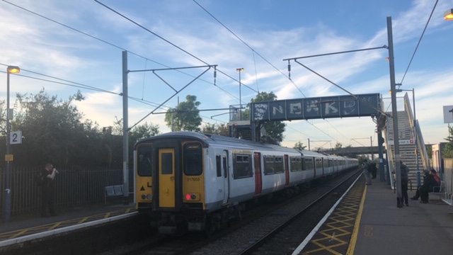
The UK is in an obesity crisis. Around a third of children are obese or overweight by the age of 11 in England, one of the highest figures in the world. In the report it is suggested that Davies wishes to discourage excessive snacking for children whilst using public transport for local travel to and from school. The ban, if approved, will apply to adults and children, and will not apply to Inter-city trains with buffet cars or people who need to eat or drink because they have a medical condition. The ban will not apply to people drinking water. 

I believe we need to be encouraging as many people as possible to think about using alternative methods of transport to private motor vehicles, such as public transport. Banning consuming food and drink on public transport could discourage public transport as an option. Whilst the report states the ban would exclude Inter-city trains, not all 'long' journeys are using Inter-city trains. For example Grantham to London is roughly 70 minutes using Inter-city trains where eating or drinking would be allowed, but what about Grantham to Liverpool Lime Street using a service that would be classed as 'local services' that takes 3 and a half hours? 

The UK is in a climate emergency and too many peoples default mode of transport is public transport. If only there was a transport solution that improves public health and does not add to the climate emergency that the chief medical officer could promote in her outgoing report? 


There is and she did - active travel. Walking and cycling are great ways to travel, especially in urban areas. It is cost effective, healthy, great for air quality and also fun. Recommendation 4.2 of the report states "increase dedicated funding for active travel infrastructure by rebalancing investment in vehicle travel infrastructure towards walking and cycling", not that any media reporting Davies' report acknowledges this. 


Overall, I believe banning snacking on public transport is not the correct way to deal with childhood obesity and overall improvements in public health. My post has focused predominantly on railways and has not even touched the debate on other forms of public transport from the London Underground, to the DLR, or buses. There are many positives in Dame Sally Davies' out going report, however, the media has not published these positives and has instead focused on her suggestion to ban snacking on public transport as ultimately it is not a good idea. 

Sunday, 25 August 2019

28-29/270 - Kenton and Northwick Park

There are two stations in north west London that appear as they do not have a lot in common. They are on different lines, opened 11 years apart and one was nearly closed permanently in the 1980s. Despite being two completely different stations, Kenton and Northwick Park have one thing in common, they share an OSI.


An Out of Station Interchange (OSI) occurs when two separate stations are geographically located close enough it is deemed that if a journey requires you to change between the two stations on foot, that is still classed as one journey. For example, the quickest way to travel from Harrow-on-the-Hill to South Kenton would be to take the Metropolitan line to Northwick Park, walk to Kenton station, and take the Bakerloo line (or London Overground) to South Kenton. Despite this being two separate journeys, because Transport for London have classified this as an OSI, it will only cost you one journey.

TfL have recently done more to promote OSI's and on foot interchanges, most notably in the December 2018 tube map where little dashed black lines appeared dotted around London to highlight "Under a 10 minute walk between station". The dashed lines have received criticism. Some critics suggest from a first glance the lines look similar to the northern line, suggesting numerous branch lines. I also believe that TfL have missed some stations that are within close enough proximity to require a connection on the map, especially West Ruislip to Ickenham. 

The first railway in the area opened in 1837, the London and Birmingham Railway, which would be within close proximity with Kenton station. Four decades later in 1880 the Metropolitan Railway extended from Kilburn (now on the Jubilee line) to Harrow (now named Harrow-on-the-Hill), which passes through the location of Northwick Park station. Kenton station opened in 1912 when the London and North Western Railway opened their 'New Line' from London Euston to Watford Junction. The 'New Line' ran alongside the London and Birmingham Railway. Bakerloo line services started serving Kenton in 1917. Northwick Park station opened on the Metropolitan line in 1923 as Northwick Park and Kenton. 

Kenton station is a quiet station with just over 2 million passengers using the station each year. The station entrance is barely noticeable from the A4006, the roundel and signage is on the opposite side of the road. The Bakerloo line and London Overground share the tracks through this section from Queen's Park to Harrow & Wealdstone. Kenton station closed in September 1982 as Bakerloo line services were closed north from Stonebridge Park. The closure was short-lived and Kenton station reopened in July 1984. 


A short walk away, Northwick Park is also barely noticeable. Access to the station can be achieved by a passage from Northwick Avenue, or a series of paths on the other side of the station. Despite only being served by 'slow' Metropolitan line services, last year Northwick Park was used by nearly 2 and a half million more passengers than nearby Kenton. It takes less than 20 minutes to travel from Northwick Park to Baker Street on the Metropolitan line, where as it takes over half an hour from Kenton to Baker Street on the Bakerloo line. Considering the close proximity this could be a factor in the disparity in the passenger usage figures. 


Why not travel to north west London and experience one of London's classic Out of Station Interchanges. If you are planning on doing the tube challenge visiting all 270 stations in 24 hours, this interchange is a classic tactic. For more London transport trivia, follow me on Twitter and Instagram @TubeSpottingDan 

Thursday, 15 August 2019

The Human Tube Map


On Sunday 4 August 2019 I, like 180+ other people, traveled to Crayford in south London to do something exciting and take part in the Human Tube Map. Organised by Geoff Marshall and Vicki Pipe, the duo behind All The Stations, nearly 200 people wearing different coloured T-Shirts arranged to form the shape of the tube map. The result was fantastic, and a lot of fun. The YouTube video can be found here


If you want to try and spot where I was standing, I was roughly where Tower Hill is and wearing a green t-shirt for the District line. We all got to chose which T-shirt we wanted to wear. Speaking to people on the day, many opted for the colour that represents their favourite line, or station, or the line they live on. The reason I chose green was simple, it was the only plain coloured T-shirt I own! 


Being part of the Human Tube Map was an enjoyable experience. After we arrived, we organised ourselves into our lines before being arranged out on the map, line by line. Central line was first, then the northern line, then Piccadilly line, circle and district lines followed (I can't remember the final pattern!). It was great to meet Geoff and Vicki and to see many people who I only know through Twitter and social media. 

Tuesday, 13 August 2019

Discussing the Emirates Air Line

If you are planning a day out in London, how many people say "let's go on the Emirates Air Line"? Not many, just 1.3m people a year travel on the Emirates Air Line. The British Museum, Tate Modern, and London Eye all receive at least three times as many visitors each year. 7 years since opening in June 2012 I ask the question, has the Emirates Air Line been a success? 


Costing £60m, the Emirates Air Line is a 1-kilometre gondola crossing the river Thames from North Greenwich to the Royal Docks. Transport for London was committed for the project to be opened in time for London 2012 Olympic Games, they were successful, but at £35m over budget. When building the Millennium Dome (now known as the O2) the developers were keen to provide a car free transport strategy for visitors, and the idea of a cable car emerged. But since the idea emerged, North Greenwich has seen the Jubilee Line Extension and the Docklands Light Railway on the north side at Royal Docks. 

The 36 gondolas can accommodate a maximum capacity of 2,500 passengers per hour, yet five months after opening, the usage data revealed that the Emirates Air Line was operating at less than 10% of its capacity. It was hoped that commuters may use the service, so a special commuter fare was established costing £16 for 10 trips, however, just 0.01% of journeys were made using this fare. In November 2013 just four Oyster card users registered for a discount if they made more than five journeys a week. So if commuters are not using the service, who is?


TfL market the Emirates Air Line as a "unique view of London", and a cost of just £3.50 for adults using Oyster it is a cost-effective way of seeing views of 'London'. The London Eye costs £27 and lifts to the viewing gallery at the Shard cost £25. Although considerably more expensive than the Emirates Air Line, the London Eye and the Shard are more centrally located and offer better views of London. If you want views of St Paul's, Tower Bridge, the Tower of London or the Houses of Parliament, travelling on the Emirates Air Line would be a disappointment. A tourist tip, if you want these views but believe the London Eye and the Shard are too expensive, try the Sky Garden, tickets are free and you get similar views. 


The Emirates Air Line is ultimately a piece of transport infrastructure. With poor user ship, I am critical of its success, especially when Sustrans were commissioned by TfL in 2008 to review a proposed pedestrian and cycle bridge in east London. The study revealed that "the bridge is feasible" and at an estimated cost of £66m, just £6m more than a poorly used gondola, and the bridge would have provided active travel links over the river Thames benefiting major business districts and the environment. 


Urban cable cars across the world have been very successful. In 2004 Medellin, Columbia, became the first city in the world to integrate cable cars into an existing subway system. Cities across the globe have been following suit, urban cable cars are means of transport in Nizhny Novgorod in Russia, La Paz in Bolivia, and Ankara in Turkey.


I do not believe the Emirates Air Line has been as successful in London as it could have been. It is in the wrong place to capture tourists and it does not provide useful transport links to an area served by the Jubilee line to the south and the DLR to the north. Ultimately I am unsure if Emirates Air Line is a tourist attraction or a transport solution. Would a cable car be beneficial to London? I think it could if it offered a service that was more attractive than alternative transport modes, including driving and using public transport. If you have not visited the Emirates Air Line, I do recommend you have a visit and make your own opinion. There are somethings that TfL have done well with the cable car, including the branding, it does feel like a TfL service. Each gondola has a red moquette, the cable car is identified by roundels and the wayfinding matches TfL's font.

Have you used the Emirates Air Line? Do you agree with my observations? Follow me on Twitter and Instagram (@TubeSpottingDan) for more conversations on transport in London. 

Wednesday, 24 July 2019

"Want to experience hell? Try getting on the central line at rush hour in London on a warm day"

London is currently experiencing a heat wave. Temperatures today have hit 33C and with a record breaking 39C temperatures predicted for tomorrow, it is important to stay cool. Unfortunately, travelling in London can be very warm, especially on certain lines. "Want to experience hell? Try getting on the central line at rush hour in London on a warm day."


Certain lines have a reputation of being extremely uncomfortable during the summer months, especially the Central line. There is even a Twitter account dedicated to commuters experiences on the line, @centrallinehell I saw a poll today on Twitter where 80% selected the Central line as the hottest. Is it fair that the Central line is refereed to hell during summer? What is the 'hottest' line in London?


According to figures from Transport for London during last year's heatwave, the hottest line was actually the Bakerloo line with an average hottest temperature of 31.04C. In second place was the Central line with a temperature of 30.47C, third was the Victoria line with 28.03C and with 27.98C, the Northern line came fourth. The other lines without air conditioning experienced 27.3C (Piccadilly line), 26.57C (Jubilee line) and 25.95C (Waterloo and City line). 


The S7 and S8 Stock trains that serve the Circle, District and Hammersmith and City lines, and Metropolitan line respectively, are the only London Underground units to feature air conditioning.  These trains entered service from 2010 to 2017 and only serve the sub-surface lines. The Class 345s that serve TfL rail have air conditioning, some of the trams also feature air conditioning, and the new Class 710s on the Gospel Oak to Barking line have air con. The New Tube for London, which is expected to replace rolling stock on the Bakerloo, Piccadilly, Central and Waterloo & City lines, will experience air cooling. This method is currently used on the Class 378s on the London Overground.

A specially thank you goes to London Overground and Transport for London. Yesterday afternoon a member of staff at Walthamstow Central was handing out a London Overground branded water bottle. In heat waves like this it is important stay hydrated. TfL have produced reminders to "always carry water", and as Geoff Marshall reminds us, we need to carry water "and actually drink it". 

Wednesday, 19 June 2019

26-27/270 - Rickmansworth and Croxley

Located in Hertfordshire, both Rickmansworth and Croxley stations relate to one of my favourite facts about the London Underground. Both stations are served by the Metropolitan line, but Rickmansworth also receives National Rail services from Chiltern Railways on the London to Aylesbury line. Rickmansworth and Croxley stations are located in zone 7 and feel a million miles away from zone 1 and central London.


Ricmansworth opened in September 1887 as a terminating station of the Metropolitan Railway as the company extended services from Pinner. Metropolitan Railway services extended to Chesham two years later in 1889. The Metropolitan Railway would eventually terminate in Brill, Verney Junction and Aylesbury, but services this far out of London gradually closed from 1935 to 1961, predominantly due to the electrification of the majority of the line. Electrified services began serving Rickmansworth in January 1925, and the final steam service to leave Rickmansworth was the Rickmansworth-Watford shuttle in September 1961.

The Rickmansworth-Watford shuttle was re-introduced in 1987, however, just one each way a day, the Rickmansworth to Watford service left early morning, and the Watford to Rickmansworth service left in the late evening. When S8 Stock trains were introduced, the shuttle was extended to Amersham to Watford, but still just one service each way.


The shuttle utilises the North Curve, a curve a track that links Rickmansworth and Croxley. Due to the infrequency of services, this track does not appear on the London Underground map. Throughout the rest of the day, if you want to travel between the two stations, you will have to change at Moor Park. The North Curve that connects Rickmansworth and Croxley goes under a tunnel, which is the only tunnel on the London Underground and point where services go underground, outside of the London.


Croxley station opened in November 1925 when the Metropolitan Railway extended to Watford. The station was originally named Croxley Green, however, the nearby Croxley Green station operated by London and North Western Railway led to confusion. In 1949 the Metropolitan Railway station was renamed to simply Croxley. The London and North Western Railway's Croxley Green was temporarily closed in 1996, but by 2003 it was decided that the station and the rest of the Watford-Rickmansworth line would be permanently closed. 

Major engineering works were planned to take place just north of Croxley station as part of the Metropolitan line extension. Trains would have diverted onto the Croxley Rail link, and new stations would have opened at Cassiobridge and Watford Vicarage Road, and continue to Watford High Street and Watford Junction. These works would have resulted in a closure at Watford station. Despite works commencing, it was announced in January 2017 that works had stopped due to a funding issue. 


Why not board a train and travel in the only underground section of the London Underground outside of London? If you do not fancy getting up early, you can best spot the tunnel from London bound services between Rickmansworth and Moor Park. 

Monday, 3 June 2019

"When one station closes, another one opens" - London's newest railway station, Meridian Water

On Friday 31 May 2019, London's former least used station, Angel Road, closed. The 19:52 service to Stratford became the last station to depart from the quiet north London station. Angel Road ultimately closed because 580 metres to the south a station has been constructed as part of the Meridian Water development, a major a £6 billion regeneration programme in Upper Edmonton that will see 10,000 new homes being built.


Today, Monday 3 June 2019, a few days after Angel Road closed, London gained its newest station, Meridian Water. The Secretary of State for Transport, Chris Grayling, and the Deputy Mayor of London for Transport, Heidi Alexander, opened the station on Monday morning. The 05:57 Greater Anglia service to Liverpool Street became the first train to depart from the new station. Although I was committed to boarding the last service from Angel Road, like Chris Grayling and Heidi Alexander, I was not prepared to wake up at 05:00 on a Monday morning, so I visited Meridian Water after work.

Until the new time table is released in September 2019, Meridian Water will receive the same infrequent service pattern that its predecessor did. This will however change, and services from Meridian Water will eventually be much more frequent. The Meridian Water station build and Lea Valley line improvements was an impressive project, building a railway station and extra track, with two railway lines with frequent rail services still in operation.


A third track has been added to the Lea Valley line from Meridian Water to just north of Lea Bridge station. This track will enable services to run on this line every 15 minutes in each direction. It is likely that half of the services will terminate/depart at Meridian Water from the bay platform, platform 2, and the remaining services will terminate/depart from Hertford East or Bishops Stortford.


The station has been future proofed by building four platforms. Platforms 3-4 are in operation, and platform 2 will be in operation from September. Platform 1 has been prepared for, but no track has been laid yet. Meridian Water is also on the proposed Crossrail 2 route, which is expected to open in the 2030s. It is expected that 4 million people will use the station each year, this is 125 times more than the number of people that used Angel Road in 2017-18 according to the Office of Rail and Road statistics. Already on the first day, there were clearly 'regular passengers' using Meridian Water, 12 people boarded the 17:53. There were also fellow rail enthusiasts and train spotters visiting the station for the first time in operation. 

Angel Road station has already seen substantial works over the weekend. Despite closing on Friday evening, by Sunday evening the footbridge was removed and the platforms had been completely stripped. If you are planning on visiting Meridian Water, the station is currently named 'MWRWSTN' on Network Rail's website, live trains and dot matrix boards along the line.


Although the station is less than 24-hours into operation, there are already notable things to be aware of. If you visit, try and find the TfL map that has both Angel Road and Meridian Water, perhaps TfL and/or Greater Anglia were expecting the opening of the station to be delayed? It is also interesting to note two things I believe are missing. There is no British Rail symbol outside the station, and the platforms signs from the concourse are laminated A3 pieces of paper, a likely last minute job?


For more photos and videos of the final day of Angel Road, including the 19:52 service, and updates from the first day of operation at Meridian Water, find me on Instagram and Twitter where my name is @TubeSpottingDan