
In late winter/early spring last year I visited the United States and I spent a lot of time in Boston. Not only would I regard Boston as one of my favourite cities, but it also has an interesting transport history. The Tremont Street railway opened in 1897 between Park Street and Boylston Street, making this section the oldest transit subway in the United States that is still in use. The subway in Boston is operated by the Massachusetts Bay Transportation Authority (MBTA). The MBTA operates heavy rail, light rail and bus transit services that is collectively known as the MBTA subway, or as Bostonians call it, the T. Although some Bostonians talk negatively about the T there are many aspects of the system that I like.
The T comprises of five lines, 133 stations and caters for over 350 million users a year. Three lines are classed as heavy rail, one is a light rail and one is a short light rail line. The Silver line also appears on the MBTA map, but this is a bus system, although some sections do run underground. Of the 133 stations, just 26 are underground.
Your first impression of the T will likely come from travelling the three miles from Boston Logan airport to Downtown Boston. The network appears old, however I find this charming. The current rolling stock was built from 1979, however, in recent years the MBTA have invested in new stock. In addition, the Green Line is currently being extended by 4.3 miles north of Downtown Boston. Phase 1 started in 2012 and the entire extension is due to be completed in 2021. With 230,000 daily users, the Green Line is the most heavily used light rail line in the United States.
Using the T
Firstly, one of the things I like most about the T is how easy it is for tourists to understand. The five lines are named after colours; Green, Red, Orange and Blue. This is not a typo, somewhat confusingly the

Ashmont to Mattapan high speed line is coloured red, but because it is not a heavy rail it is not part of the red line. However, to access this high speed line you need to catch a red line train to Ashmont. As much as I love the heritage of the London Underground with names for lines, it can be confusing for visitors.
Secondly, on the map of the MBTA each branch has a number or letter. This makes it is much easier to know which train to catch. Another aspect I like about the T is the platforms are named Inbound and Outbound. This can get slightly confusing in Downtown Boston, but it is still much more simpler than being in London and told to catch a train from the Westbound platform on the Northern Line.
Why do Bostonians talk negatively about the T? Boston is often hit by large snow storms during winter, and this can bring the system to a halt, especially the Green Line which outside of Downtown Boston is a tram. Also, outside of peak times, the service can be rather patchy. The system also operates largely at capacity and it can be difficult to find a seat.
Paying for the T
Boston has its own version of the Oyster Card, the CharlieCard. Single journeys cost $2.75 (or $2.25 if you use a CharlieCard), or you can purchase a daily and weekly pass for $12.00 or $21.75 respectively, which can also be loaded to a CharlieCard. A monthly link pass costs $84.50 and there are discounts for students.
What to do in Boston

The first thing to do in Boston for all railway or transport enthusiasts is to visit Boylston station. Not only is Boylston a must visit station due to being, along with Park Street, the first station to open in Boston, historic Boston Trolleys are kept on display. PCC #3295 and
Type 5 #5734 are often on display at Boylston. Boylston and Park Street stations have now been designated a National Historic Landmark.

However, despite my love for railways and subways, the best way to explore Downtown Boston is by foot. Many stations in Downtown Boston are ridiculously close. For example, the first section to open in 1897 is just a five minute walk across Boston Common. One of Boston's best attractions is the Freedom trail, a 2.5 mile walk that comprises of 16 key locations in American history such as the Old South Meeting House, the organising point of the Boston Tea Party, the Old State House, where the Declaration of Independence was proclaimed in July 1776, and Faneuil Hall, also known as the Cradle of Liberty was where Samuel Adams often hosted talks to encourage independence from Great Britain.

Whilst in Boston there is plenty to do. Boston is a city that loves sport, and is home to the Boston Bruins, Boston Celtics, New England Patriots (just outside of Boston) and perhaps most famously, the Boston Red Sox. The Red Sox play at Fenway Park, and when tickets start from $30 it is well worth a visit. The nearest T station to Fenway Park is Kenmore on branches B, C and D of the Green Line.
Boston is also home to some amazing food, and especially sea food. There are two items of sea food you need try w

hilst you are in Boston; Boston Clam Chowder and Maine Lobster Roll. There are so many good places to get these items in Boston, but as a tourist you will likely end up at Quincy Market at some point, where there are plenty of opportunities to get both. The nearest station to Quincy Market is Aquarium on the Blue Line. Another area to get great food is the North End, which is famous for being home to Boston's Italian community. A Bostonian favourite is Mikes Pastry shop which sells amazing cannoli, Limoncello is my favourite flavour. The North End is home to numerous restaurants, and caters for different budgets. The nearest station to North End is Haymarket on the Orange Line and Green Line. Whilst you can get Dunkin Donuts everywhere on the east coast of America, Boston really does "run on Dunkin".

Boston is also home to the most photographed street in North America, Acorn Street. Acorn Street is located in the desirable district of Beacon Hill. Beacon Hill also features Charles Street, home to many boutique shops, the Massachusetts State House, and the Bull and Finch Bar, the inspiration and exterior shots for the comedy Cheers TV series. A stones throw away from Beacon Hill is Back Bay. Back Bay features one of America's best shopping avenues, Newbury Street. Back Bay is also home to cultural institutes such as the Berklee College of Music, the Boston Conservatory and Boston Public Library.
Finally, across the Charles River from Boston is Cambridge, MA, which is home to some of the world's most prestigous educational istitutes, including Harvard and M.I.T. Cambridge is well worth a visit and is easily accessible by the T. Harvard and Kendall stations, both on the Red Line, are the nearest T stations to Harvard and MIT respectively.
 The DLR is a an automated light metro system in East London that comprises of 45 stations over 38km of track, with nearly 120 million annual passengers. The DLR is infamous for minimal staffing, just five of the 45 stations are underground (Island Gardens, Cutty Sark for Maritime Greenwich, Bank, Stratford International and Woolwich Arsenal) and in order to comply with fire and safety requirements, these five stations are staffed.
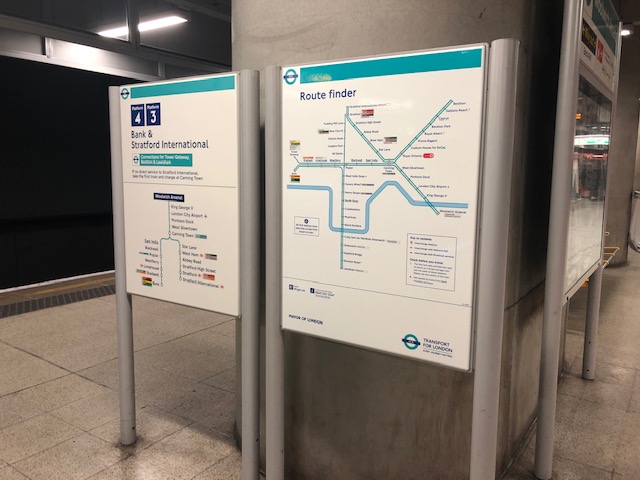 The official opening of Woolwich Arsenal DLR station took place on 12 January 2009. Despite the line heading west towards Bank via. London City Airport, due to the curvature of the river Thames, DLR trains actually head east from Woolwich Arsenal before turning west back towards the City.
  area of Woolwich has an interesting relationship with transport. Since 1889, a free vehicle ferry has operated from Woolwich to the south of the Thames, and North Woolwich to the north. However, the ferry has seen decreasing passenger figures since the DLR opened at nearby Woolwich Arsenal and the construction of a foot tunnel. Despite falling passenger numbers, there are currently no serious plans to withdraw the ferry.
 area of Woolwich has an interesting relationship with transport. Since 1889, a free vehicle ferry has operated from Woolwich to the south of the Thames, and North Woolwich to the north. However, the ferry has seen decreasing passenger figures since the DLR opened at nearby Woolwich Arsenal and the construction of a foot tunnel. Despite falling passenger numbers, there are currently no serious plans to withdraw the ferry.
 Woolwich also currently has a Crossrail station under construction that was due to open in December 2018. Crossrail will take just 8 minutes to get from Woolwich to Canary Wharf, considerably quicker than the current 22 minutes journey time it takes to get from Woolwich Arsenal to Canary Wharf via. the DLR and Jubilee line. The DLR Woolwich Arsenal station, Woolwich Crossrail station and Woolwich Arsenal pier will all be within a short walking distance. Like most Crossrail stations, Woolwich will use natural light as much as possible and the entrance will connect to wider urban public realm.


